Open for the 2010 Summer Season
Plows and graders have cut through the late spring snowpack allowing some of Colorado’s most scenic highways to open for the 2010 summer season just in time for the Memorial Day weekend. Openings are always subject to change, dependent on Mother Nature; check on the latest conditions before heading to the hills.
-
Mount Evans Road – CO5 – This seasonal road stretches 14 miles from Echo Lake on CO 103 to 14,130’, just 134’ below the Mount Evans summit. The road claim
 s the title of Highest Paved Road in America. Watch for Big Horn Sheep on the rocky slopes and plan a stop at the Mount Goliath Natural Area. Twisted and ancient bristlecone pines, some more than 1,600 years old) grow in this transition zone between sub-alpine forest and tundra. An access fee applies; exempt for Federal Recreation Passport holders.

-
-
-
Trail Ridge Road – US34 – Traversing Rocky Mountain National Park and the Continental Divide, Trail Ridge Road extends 48 miles between Estes Park and Grand Lake. Eleven miles of the highway are above
 treeline. Forests, lakes, rugged mountain peaks, tundra, wildlife, wildflowers and grand vistas regale park visitors. The popularity of the route often creates slow going – don’t rush, enjoy the view. Icy conditions frequently closes the road overnight early in the season.

-
Independence Pass – CO82 – This narrow, winding road connects Twin Lakes on the eastern side of the Continental Divide with Aspen on the western slope. Along the 37-mile paved route outdoor enthusiasts find lots of opportunities for hiking, camping, fishing a
![Slide Scan_Steven and Shawn_8x10[1]](https://wheretogotravelusa.com/wp-content/uploads/2010/05/slidescan_stevenandshawn_8x101_thumb.jpg?w=264&h=181 "Slide Scan_Steven and Shawn_8x10[1]") nd exploring the ghost town of Independence. Be sure to pack a camera to capture the expansive landscapes, wildlife and summer wildflowers. The faint of heart may want to skip Independence Pass, the road narrows to single lane width in several locations with steep dropoffs and tight curves. Road conditions dictate vehicle weight and height limitations. Hardy souls are rewarded with remarkable mountain scenery and experiences.
nd exploring the ghost town of Independence. Be sure to pack a camera to capture the expansive landscapes, wildlife and summer wildflowers. The faint of heart may want to skip Independence Pass, the road narrows to single lane width in several locations with steep dropoffs and tight curves. Road conditions dictate vehicle weight and height limitations. Hardy souls are rewarded with remarkable mountain scenery and experiences.
![Slide Scan_Steven and Shawn_8x10[1]](https://wheretogotravelusa.com/wp-content/uploads/2010/05/slidescan_stevenandshawn_8x101.jpg "Slide Scan_Steven and Shawn_8x10[1]")
-
 Cottonwood Pass – FR(Forest Road)209 & FR306 – The 60-mile route between Buena Vista and Almont crosses the divide at 12,126’. The road is paved from Buena Vista to the top of the Cottonwood Pass. The first 11 miles down the west side are graded gravel, auto passable except for extremely low clearance cars. From Taylor Reservoir the road follows the Taylor River, popular with fishermen and rafters. At Almont turn right to Crested Butte or left to Gunnison.

-
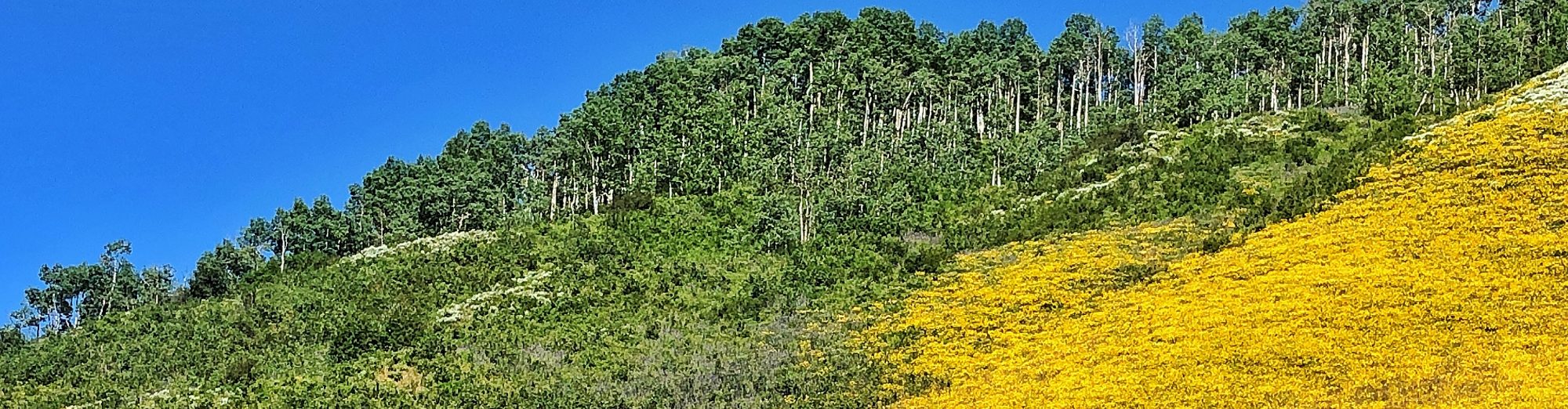
Kebler Pass – GCR(Gunnison County Road)12 – This 30-mile
 segment of the West Elk Loop Scenic Byway connects Crested Butte with CO133. All but 2 miles are graded gravel. Kebler Pass is one of the state’s best drives in autumn when the ample aspen groves glow in golden glory. At CO133 continue complete the 206-mile West Elk Loop back to Crested Butte or turn north to Carbondale and Glenwood Springs.
![Yellow Aspen Twig[1]](https://wheretogotravelusa.com/wp-content/uploads/2010/05/yellowaspentwig1_thumb.jpg?w=204&h=175 "Yellow Aspen Twig[1]")

![Yellow Aspen Twig[1]](https://wheretogotravelusa.com/wp-content/uploads/2010/05/yellowaspentwig1.jpg "Yellow Aspen Twig[1]")
The most dependable aspect of weather in the Colorado mountains is that it can change at a moments notice – or, no notice at all. Always be prepared for changing conditions. Even if it’s 90 degrees in Denver don’t leave home without jackets and closed-toed shoes. Properly prepared you can enjoy your mountain journey no matter how conditions may vary – crystal clear skies to ice crystals.
