Category Archives: Utah

Elko, Nevada to Vernal, Utah – October 8, 2014

Full Circle

Night 1 & Night 28

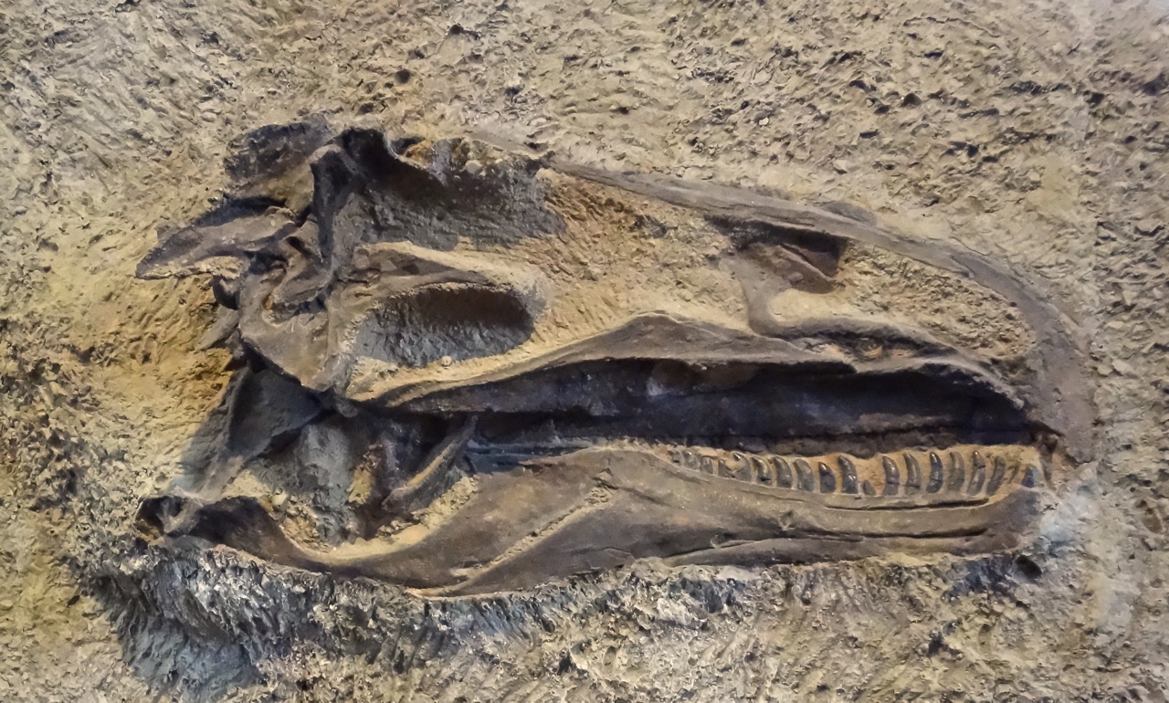
We spent the first night of our grand Northwest tour in Vernal, Utah. Now, on night 28 we’ve come full circle and spend our last night on the road in Vernal, Utah – a journey of over 5,000 miles. Tomorrow we’ll complete the final leg back home and our own bed-e-bye.


Salt Flats Highway


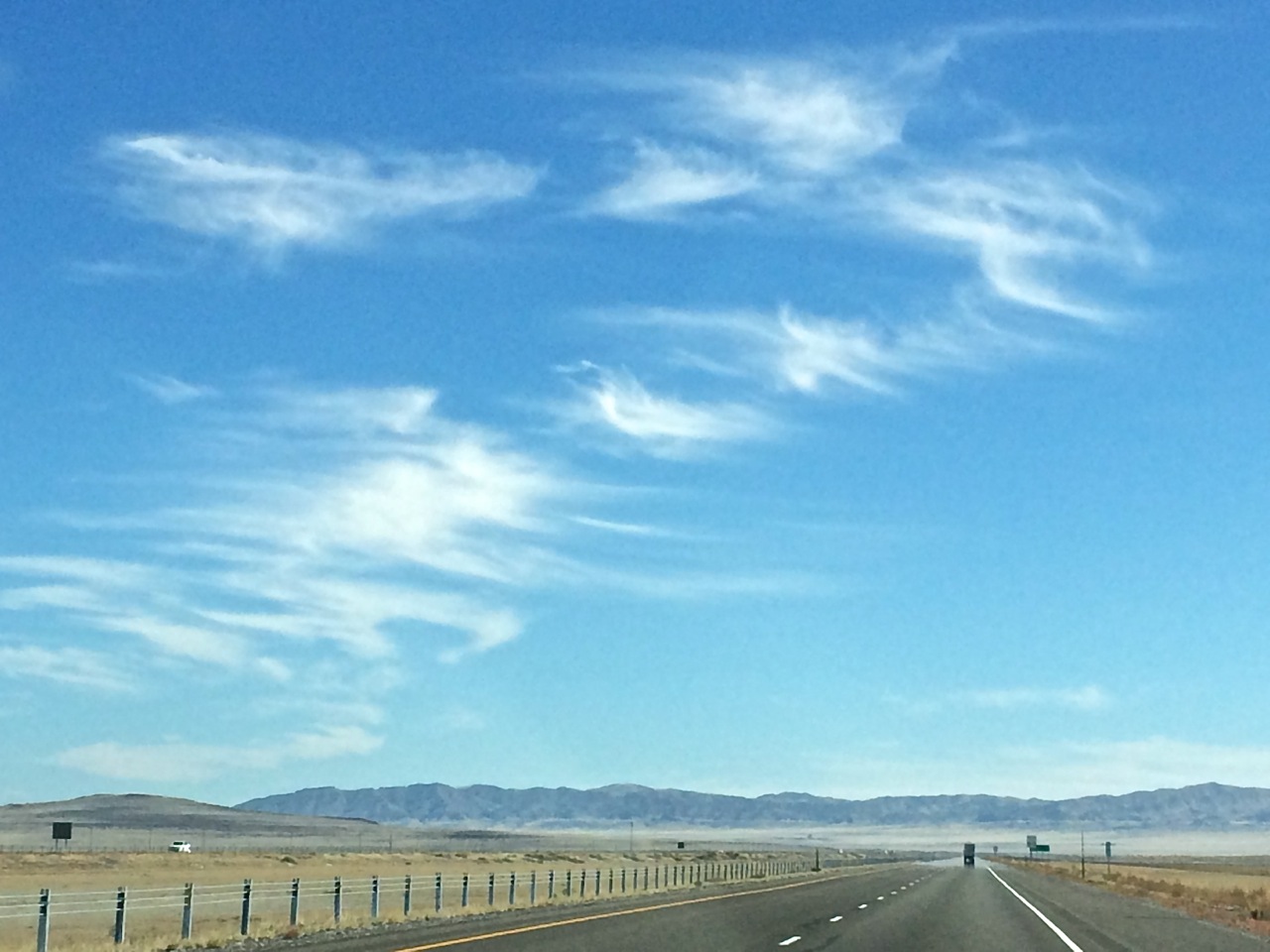
With limited highways across this area we broke our goal of limited Interstate driving, taking I-80 and I-15 from Elko to Orem, Utah. I know that previously when I’ve driven this road I’ve said, “It’s so boring”. Today I appreciate the diverse geography, cloud formations and geology. Once across the Utah state line the topography flattens and we experience the mirage effect of light, shadow and reflection. Is that a lake ahead or a glistening dry salt flat.


Salt Flats Sclupture
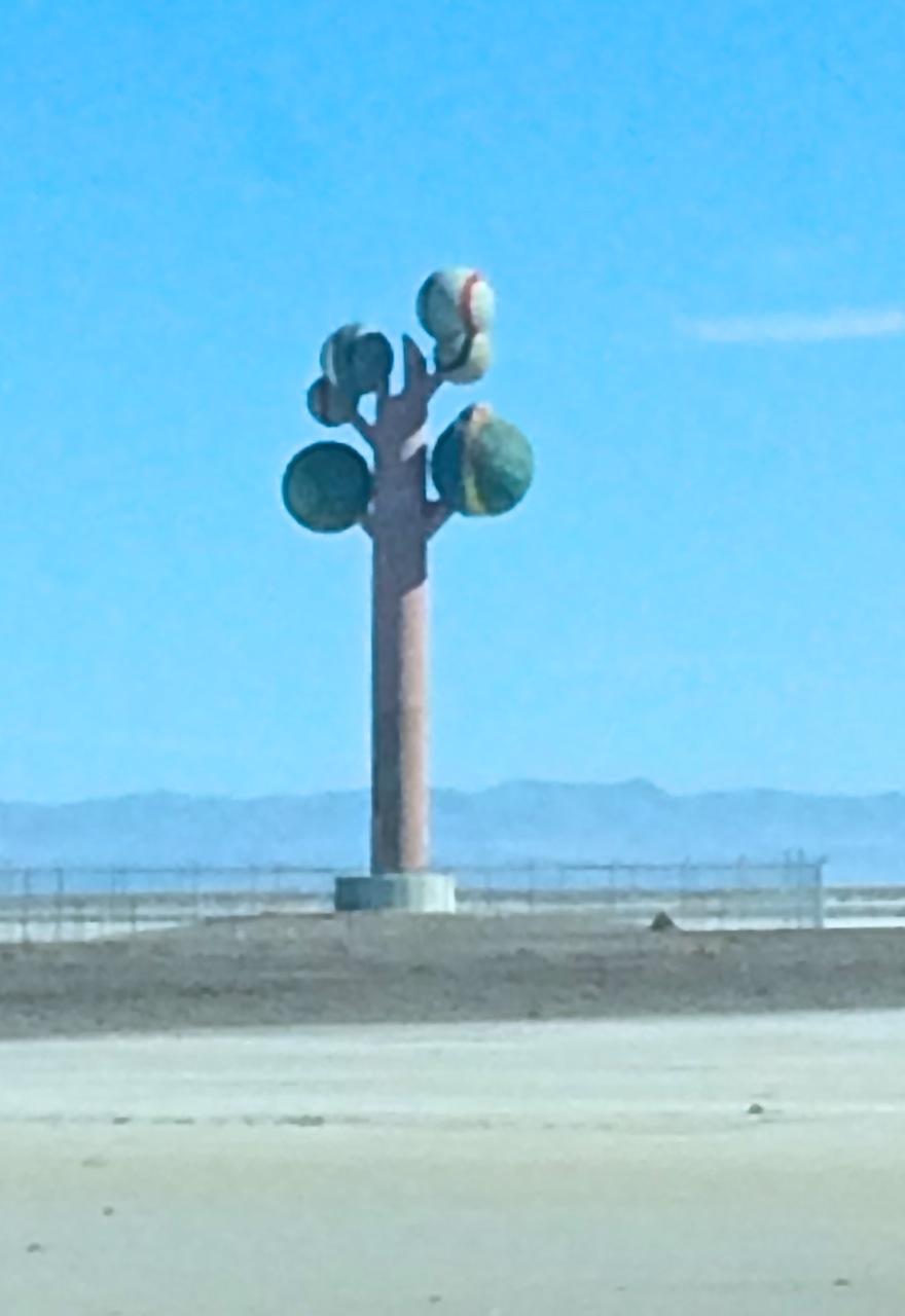
Our route crosses the California National Historic Trail several time. We discuss what it would have been like to be walking alongside a covered wagon day after day, month after month. They dreamed of new opportunities, were determined, dedicated and probably at times delusional. Today signs along the roadside warn of driver fatigue, encouraging stops at rest stops. A sculpture along the north side of the highway breaks the flat horizon and elicits comments.


Provo Canyon - Autumn Color 2


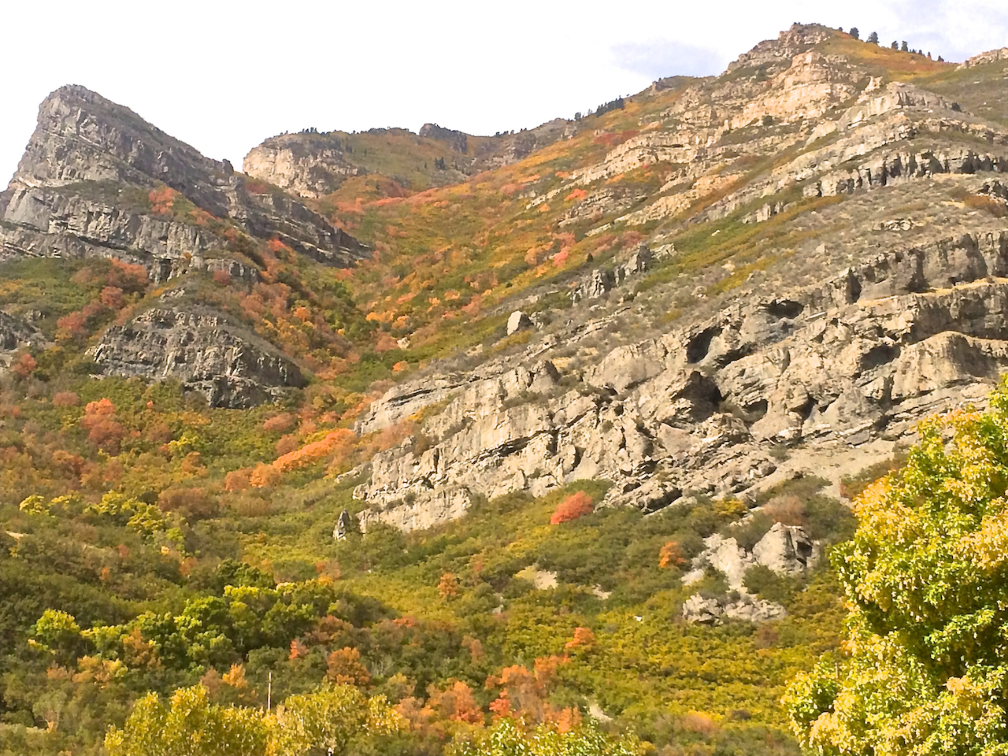
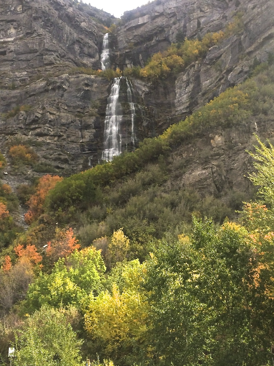
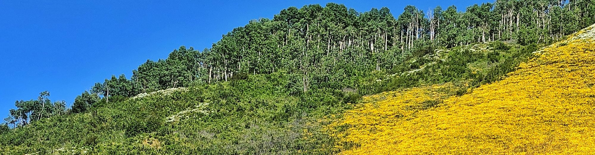
Although we’re simple trying to cover mileage today we make a slight deviation from a direct route heading south to Orem to access Provo Canyon. We’ll connect to US 40 in Heber City. Mountain foliage in every color and shade associated with autumn covers the slopes making the scenic drive even more spectacular. Numerous parks and viewpoints present opportunities to stop, stretch and admire the canyon or take a short walk to the base of Bridal Veil Falls.


Bridal Veil Falls - Utah


Vernal, Utah – September 12, 1014

Floral Abundance

in Vernal, Utah

Vernal - Petunias

Many cities decorate their business districts during the summer with hanging plants or planters filled with colorful blossoms but never have I seen a display like the one in Vernal, Utah. Petunias spill to the sidewalk from waist-high planters, drape over walls and cascade from large baskets hanging from every lamppost.


Vernal Hanging BasketI learned that the program started by the Chamber of Commerce, and now coordinated by the city, is in its 27th year. Depending on sources, I heard that there were either 900 or 1500 containers involved. I would believe the latter for how many blocks through Main Street are adorned. Citizens sign up in the fall to be part of the planting brigade each spring. As we were leaving town we saw watering trucks on both sides of the streets working their magic.


Thank you Vernal for beautifying your town and sharing the floral abundance each summer.

Dinosaur National Monument

Travel Log – September 11, 2014

Centennial, Colorado – Vernal, Utah

Ridge at Dinasaur NM

Although the main goal for the day was putting some miles behind us as we head towards the Pacific Northwest we must have a least one activity. Our last visit to Dinosaur National Monument occurred in 1973, wasn’t it time for a revisit? What was intended as an hour off the highway stretched to nearly three as we explored the southwestern section of the park north of Jensen, Utah.


Quarry Interior Please Touch

The Quarry Exhibit Hall encloses a wall of an excavation site encasing more than 1,500 dinosaur bones including Allosaurus, Apatosaurus, Camarasaurus, Diplodicus and Stegosaurus of the Jurassic Period. To every 4-year-old’s delight, in one area, you’re actually encouraged to touch. Or, see how you measure up to a femur bone.


Skull Bob - Measuring Up

The Monument includes much more than just fossils – canyons and fertile valleys the Green and Yampa Rivers,  ancestral history dating back thousands of years and the remnants of twentieth-century ranch life. We followed the Tour of the Tilted Rocks along Cub Creek Road searching out petroglyphs and pictographs – rock art left by inhabitants centuries past.


Goats & Guys

Rock NecklaceThe longer we study the panels the more details we note. While some images are easy to decipher (goats and men), others are left to interpretation.  Where they messages, historic records or decorative? Looks like a necklace design to me.


The road ends in a secluded, shady vale that was home to Josie Basset for 50 years. Walking through the dirt-floored cabin we can only imagine life as she knew it. We’re enticed by a couple of  trails leading to nearby canyons but it’s time to hit the road towards tonight’s destination – Vernal, Utah.

Josie's Cabin

Remembering 9/11

One regret from today is that we didn’t take the time to capture photographs of two inspirational sights. Two Colorado towns we passed through made special efforts to mark this 13th anniversary of the 9/11 terrorist attack.


In front of the Granby fire station an extra large American flag hung suspended between the outstretched ladders of two gleaming red fire trucks.


Along the entire length of Victory Avenue (the route of US40) in Craig, Colorado was lined with literally hundreds of American flags, a project of the local Rotary club.


Stirring sights noting respect, honor and resolve – We will NOT forget!

Visit Arizona – #3

Lake Powell Boat Tours


To see Lake Powell one needs to get out on the water. Many who arrive without their own boat plan to rent – anything from a 75-foot houseboat to a SUP (stand up paddleboard). If time is limited or you want someone else to be in charge take one of the guided scenic tours available from Wahweap Marina at Lake Powell Resort (near Page, Arizona).


Choose from four options:

  • Antelope Canyon Boat Tour – 1.5 hour trip into perhaps Lake Powell’s best know canyon. The Navajo Sandstone walls squeeze closer and closer together as the boat goes deeper into the canyon – to the point you feel like you could reach out and touch the towering walls.

  • Canyon Adventures Boat Tour – 2.5 hour tour exploring Antelope Canyon and Navajo Canyon known for sheer walls ladened with "Navajo Tapestry".


  • Rainbow Bridge Boat Tour – 6-hour, 50-mile trip to Rainbow Bridge National Monument. After two hours of travel time the boat docks so that passengers can make the 1.25-mile (round trip) hike to view Rainbow Bridge. The natural sandstone span is the world’s largest known bridge, standing 290′ tall and stretching 275′ across Rainbow Canyon. Neighboring Indian tribes believe Rainbow Bridge to be a sacred religious site, saying special prayers before passing beneath the Bridge. Failing to say the appropriate prayers is believed to bring misfortune or hardship. Say your prayers!

  • Canyon Princess Dinner Cruise – 2 hours, relax with a glass of wine and dinner as evening creeps across the lake. With luck a colorful Arizona sunset will cap the cruise evening.


For additional information, schedules, costs and reservations check out www.lakepowell.com.

Travel Log – May 31, 2012

Page, Arizona to Bluff, Utah


A longer travel day with two important stops. After a visit to the Carl Hayden Visitor Center at the Glen Canyon Dam we hit the road across the Navajo Nation. First stop was Navajo National Monument. The Monument preserves and protects several incredible Ancestral Puebloan cliff dwellings. A 1.3-mile walk takes us to an observation site of Betatakin, the remains of a 1270-1300 A.D. community nestled in an alcove under a  high arching rock cliff.


The other major stop for the day was scenic Monument Valley Tribal Park straddling the Utah, Arizona border. The buttes, mesas and spires appear familiar to movie and television viewers. Photography opportunities abound. We’re amused at the enthusiasm of a bus load of Japanese tourists as they pose with abandoned gusto.


Travel Log – May 28, 2012

Travel Rant


I’ve come to the end of another travel day and I can’t help it – I want to rant. Some days the people who cross your path are just too in la-la land I can’t imagine how they got this far.


#1 – My morning encounter was a lady in the breakfast room of the Wingate hotel in St. George. I spit a bagel and placed it in one of the toasters, the kind that you put on a wire rack on top and the toasted item comes out on the bottom . So my bagel is about to drop to the finished rack and  woman reaches in and takes the bagel. When I confront her I ask if she had sliced it and put it in the toaster. Her reply, “I thought it was automatic.” I guess she thinks everything is about her and when she enters the room it’s time for the toaster to get to work.


#2 – Memorial Day in Zion Canyon sees a steady stream of visitors and hikers in all the popular areas. A foot bridge crosses the Virgin River is wide enough to pass someone – unless, people decide to walk right down the center. We wait patiently while a steady stream comes towards us, sometimes in pairs, some stopping to take pictures,  until it is obvious we’ll have to be pushy to gain access in the opposite direction.


#3 – Driving towards Zion’s east entrance the road climbs with many switchback curves. On one curve there is a paved pull off on the inside of the curve. A car with a California license plate has stopped to take a photograph – not in the pull off but head on to  oncoming traffic. What are they thinking? Are they thinking?


#4 – As we’re checking into the Kanab Holiday Inn Express a couple is loading the only available luggage cart. Assuming (silly us) they will return it as soon as they unload we relax in the lobby with a warm fresh baked cookie. We finally decide to go ahead unload without a cart. We later meet them in the hall as they return the cart on their way to dinner – at their convenience. You can bet I had words for them.


Rarely does one day bring so many rude, thoughtless people. Thank heavens.

Travel Log – May 27, 2012

Kolob Canyon

Zion National Park


Motorist speeding down I-15 in southern Utah have no hint what’s in store if they take Exit 40. The spectacular Kolob Canyon in the northwest section of Zion National Park lies just minutes from the busy Interstate. After checking in at the Visitor Center (fee required) motorist follow a five-mile scenic drive ascending over 1000 feet in elevation to Timber Creek Overlook. Hikers find numerous trailheads for adventures into the narrow valleys of finger canyons.


Rounding a curve within the first mile the view of massive red Navajo Sandstone cliffs is simply a hint of things to come.


Frequent turnouts, many with interpretive signs, provide a place to ponder nature’s wonders or photograph the stunning scenery. Although the return is on the same road views appear different coming from the other direction.


Horse Ranch Mountain, the park’s highest peak, is found in this section of the park. Depending on the source Kolob Arch is either the longest or second longest freestanding arch in the world. Kolob Arch can be reached from the trailhead at Lee’s Pass (about 2/3 of the way up the scenic road). The hike is 7 miles, one-way, following LaVerkin Creek into the Kolob Wilderness.


Kolob comes from Mormon scripture meaning “residence closest to heaven”. Who would have guessed it was so close to I-15’s Exit 40?


Travel Log – May 26, 2012

Rain, Snow, Wind

Happy Memorial Day Weekend

Guess what’s in that cloud! Yes, the date is May 26 but at Cedar Breaks National Monument near Cedar City, Utah the clouds rolling in brought snow and wind. The car thermometer went as low as 26 degrees and a ranger said the wind was gusting up to 60 mph, averaging 30-40 mph. Even with four layers – shirt, hoodie, fleece, coat – fleece headband and gloves I could only tolerate being outside for a few minutes at a time. Can’t image what the chill temp was – COLD.


We started the day with a light rain at Bryce Canyon National Park, and wind. All of southern Utah seems to be on high wind alert. After the rainy beginning we were happy to see increasingly bluer skies as we headed through Red Canyon and the Dixie National Forest on our way to Cedar Breaks. The monument’s visitor center just opened for the season yesterday. One of the rangers said, “I’ve been here five years and it seems to be a law that we have snow on opening weekend.” A toasty fire in the Visitors Center provided a warm up before heading back to the car. While the weather limited our activities the views are enticement to return on a better weather day.


Travel Log – May 25, 2012

Grosvenor Arch


I wouldn’t say Grosvenor Arch was on my bucket list but it’s certainly been on my Utah To Do list for many years. Photos of the double arch are frequently seen in articles, videos and guidebooks and it’s had a certain appeal for me. One reason probably is because it is in the backcountry, not near a highway viewpoint.


The arch stands 19 miles south of Cannonville, Utah, down Cottonwood Creek Road. The road is paved the first nine miles to Kodachrome Basin State Park, from there it’s 10 miles of rock and dirt. I enquired about road conditions at the Grand Staircase Escalante National Monument Visitor Center and was given very actuate details. In fair weather a high-clearance,  two-wheel drive car would have no trouble. There is some washboard but not the entire length. The road dips in one location that usually holds standing water, with a choice of two crossings I was advised to take the one to the right which is less steep. One mile before the arch a forest service sign marks a left turn. At the  parking area we find an information sign, pit toliet and paved walkway making it wheelchair accessible.


We were the only visitors all of the time we scrambled around taking photos from different angles. Grosvenor Arch was named after a former president of the National Geographic Society, Gilbert Grosvenor. It stands 152 feet tall with a 92-foot span. The remote setting adds to the drama, I was not disappointed and thought the 40 mile round-trip worth it. Check!

Smiles – May 25, 2012

Too Pooped To Pump

So says a sign hung on an old gas pump in Cannonville, Utah. It expresses my sentiments exactly after spending hours walking and taking pictures in 40+ mph winds at Bryce Canyon National Park. I may be too pooped to pump but not for a night of cowboying, off to a Western dinner and music show.